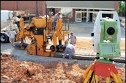
Leica PaveSmart 3D for Curb & Gutter
According to Leica Geosystems, its new automated steering-and-elevation-control system for paving machines (PaveSmart 3D for Curb & Gutter) is based on the company's completely new modular 3D software platform that uses its X-Function dataflow concept. PaveSmart 3D is aimed at contractors involved in offset slipform paving, such as curb-and-gutter, barrier, v-channel and sidewalk. The new system uses Leica Geosystems' System 1200 total station — and for certain applications, GNSS (GPS/GLONASS) technologies — to track the position of the paver in real time, in relation to a 3D model of the jobsite, in order to automatically regulate steering and elevation hydraulics to produce a finished product directly from the original 3D design.

