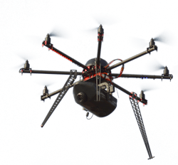
The power and potential of UAV technology in surveying and mapping is highlighted in a recent article in American Surveyor summarized by Commercial UAV News.
The article says that traditional survey methods, including the use of scaffolding, rope, and mobile elevating work platforms, are “costly, time-consuming, and require a lot of workforces.” Moreover, the piece states, “the biggest disadvantage is that you can’t guarantee workplace health and safety with conventional methods.”
Conversely, using drones keeps personnel away from potentially dangerous environments like “like rocky terrains, marsh, swamps, high altitudes, and others.” Ultimately, the article states, “drone surveying is better in every sense than the traditional methods. It’s less tedious, cost-effective, accurate, and safer.”
Six barriers to drone adoption in surveying and mapping include:
- Creating drone data workflows
- Defining accuracy needed
- Capturing the accuracy needed
- Regulations
- Training and personnel
- Managing expectations.
Read more, including how to overcome the barriers.
Source: Commercial UAV News
About the Author
Frank Raczon
Raczon’s writing career spans nearly 25 years, including magazine publishing and public relations work with some of the industry’s major equipment manufacturers. He has won numerous awards in his career, including nods from the Construction Writers Association, the Association of Equipment Manufacturers, and BtoB magazine. He is responsible for the magazine's Buying Files.

