Using Drones to Digitally Map
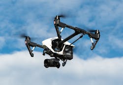
As the construction industry continues to embrace drones, BIM, data analytics, and offsite manufacturing, these technologies are becoming an essential part of conducting business, according to an article in PlaceTech. ProDroneWorx, a company that produces mapping, inspection, and surveying devices, helped produce 2D/3D digital outputs using drone technology on a project by BayTree + Readie Construction.
According to the article, the project was one of the company’s prime developments—a new 250,000 sq. ft. logistics building. The company took digital reality captures of the project, enabling both the developer and the contractor improve the digital management of the project, improve data deliverables to clients, and reduce costs and risks.
The article said survey grade 3D point clouds of all areas, objects, and structures were created using photogrammetry (the process of making measurements from photographs) within two days of flying. The models were then imported into BIM or CAD software so that comparisons could be made against the design models and between time periods to track progress.
The single high-res orthomosaics (aerial photographs that are geographically accurate) were produced so measurements could be taken from them, and were also tied into the OS grid using ground control points for global accuracy. This gave the user unique insights into the site and its surrounding area.
“The digital information produced by drone technology changed the way we managed this project; saving us both time and money,” Readie Construction told PlaceTech. “In just two days of the drone flight the 2D and 3D digital outputs were ready for analysis; which (due to the size of the project) would not always be possible using traditional methods.”
Source: PlaceTech
