Sky's the Limit with GPS Grade-Control Systems
Trimble and Caterpillar have partnered to place a GPS guidance system on the market called Computer Aided Earthmoving System (CAES), and its office/foreman twin, CAES Office. The two companies have also entered into a joint venture involving SiteVision and CAES. Look for a GPS control system with Cat's name coming out of that union, plus a new generation of laser control products. Ordering your new Cat motor grader (or other machinery) complete with a GPS control system from the factory is a concept with one foot out of crystal ball and the other on its way.
As you may know, the Global Positioning System (GPS), which is a system of 24 Earth-orbiting satellites that allows precise location of earthly objects, is now being employed to control the machines that shape (grade) the land on earthmoving projects. Using a GPS-based grade-control system for practically any cut-and-fill operation—plus a broad range of other dirt-moving and compacting applications—is designed to be so easy that you might even overhear a computer-illiterate operator exclaim, "Hey, this isn't rocket science." Though, in a matter of speaking, it is.
And it really doesn't take a rocket scientist to do the math on increased productivity and profitability realized from implementing this next-generation of automated, machine-control technology. The early adopters of GPS grade control claim about a 30-percent improvement in efficiency, speed and money saved—take your pick, because it all boils down to contractors being able to bid lower than their competitors, bid on more diverse jobs, and still put profit in their pockets.
Simplicity and significant profitability are the two biggest selling points for GPS-based machine control, which makes a lot of sense, since contractors might forfeit all that increased productivity if the technology was hard to learn and use. As it is, however, three of the leading manufacturers of GPS grade-control systems have brought to market products that operators can start using in about 30 to 60 minutes—no computer experience required.
And, because sophisticated location data can be tied to a machine's hydraulics for automatically positioning its blade's elevation and slope (according to the job's engineering specs), GPS brings payoffs by the payload. Seeing machine hours reduced, and the need for most of a site's laboriously planted grade-stakes eliminated, some contractors go so far as to say that use of GPS grade control might soon determine who stays in business and who doesn't.
The big players in the "three-dimensional" GPS grade-control market are Topcon, Trimble and Leica Geosystems. The three have already staked their territories, so to speak, with numerous two-dimensional, local-positioning systems (LPS), which use laser or sonic sensors, and with three-dimensional LPS. The latter systems use the prism reference of total robotic stations for both operator guidance (indicating to the operator how to move the blade and steer the machine) and for automated machine control (interfacing with machine hydraulics).
GPS can also be utilized just for guidance as well as for automated control of machine functions. Some manufacturers even make it possible to switch instantly from GPS to another sensor-type positioning system, depending on job requirements. In addition, the three companies CE interviewed all make it easy to layer a GPS system on top of existing LPS components that equipment owners may already have installed.
So why invest more money in a GPS control system? The simple answer is to gain capability and flexibility. Although laser systems (which must "see" a rotating laser in order to receive positioning data) do enable better accuracy for tight vertical tolerances, they provide limited 2-D perspectives and tie operators to a fairly narrow radius within which they can maneuver machines.
On the other hand, GPS systems, which only have to "see" the sky to receive positioning data, figuratively put an address on every square meter of earth. These systems act like a surveyor walking behind a machine, calculating location 10 times per second. If you shoot this precise location data into a machine's onboard computer (where it interfaces with the project's digital terrain model, or DTM), then hook this data to the machine's hydraulics, the sky's the limit on what you can do with GPS.
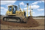
You can install these GPS-based systems on motor graders for tenth-of-a-foot blade accuracy, or use them to pump up productivity on dozers, scrapers, compactors, pavers and excavators. They simply put a faster spin on dirt-moving jobs like roads and highways, airport runways, golf courses and parking lots, as well as housing development and landfill operations.
One GPS base station (which receives satellite signals, makes any necessary corrections, then sends the corrections to GPS receivers on machines) allows any number of receiver-equipped machines to work simultaneously on a jobsite. The machines can roam from six to nine miles away without losing the base station's transmitted signals.
Regardless of which brand you may consider, GPS-based grade-control systems have a number of characteristics in common. Basic components look similar across the board. The base station (semi-permanently secured atop the office trailer or anchored in the ground) comprises an antenna to gather signals from satellites, a receiver to process location data and to make corrections, plus a radio to transmit corrected information to machines (called "rovers").
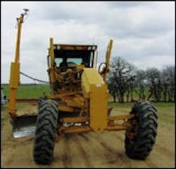
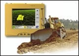
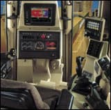
In addition, at least one antenna is mounted on the machine's blade, and the machine also has a GPS receiver and a radio. Also onboard are a color-display monitor and PC. What operators see in the cab is a 3-D DTM of the project and the machine's location relative to the big picture. But the touch screen enables operators to instantly view cross-sections, elevations and blade position diagrams.
Because GPS grade-control technology went to boot camp in the mining industry first, manufacturers have built all system components rugged and ready for a beating on construction sites. All three companies maintain that the life expectancy of their GPS control products is almost unpredictable, but point to the mining histories of their systems which have been running 24/7 for five or six years—some 30,000 non-stop hours—and are still going strong.
Expect a one-year warranty on any system, with optional extended warranties available. The products are typically sold through the manufacturers' specialized distribution networks, though occasionally equipment dealers make them available. System distributors can install the GPS control components and related hydraulics in less than a day on the jobsite.
Most distributors will tailor training to contractor needs, staying for a few days if necessary. Less than an hour gets an operator in business, but in-depth factory training is available for learning the broader functions of GPS automated control and the data management capability available. By the way, if equipment rental is your preference, many GPS control system distributors offer rental, too.
When GPS-based grade control was introduced to construction applications a couple of years ago, contractors found that operators suddenly knew more about the job than did their foremen and supervisors. That situation was corrected in a hurry with the arrival of office/foreman systems that place identical data and DTM viewing on the foreman's desk or even in their trucks. Tabulating daily or weekly progress volumes is a cinch.
Although foreman systems break out as an optional expenditure, you're looking at a ballpark start-up cost range of $90,000 to $110,000 with a base station and GPS control components for one machine. Add about $15,000 for the foreman's GPS rover package, and about $50,000 for each additional machine you equip for GPS control. Costs will dip if existing LPS components are already in place, or if you only want GPS guidance versus machine control. Expect to recover your costs in six months to a year.
Lest you walk away with the impression that all GPS-based grade-control systems are identical, we hasten to mention that Topcon, Trimble and Leica all place unique twists on their products. They've come at the task with innovative approaches, a few of which are highlighted below.
Topcon: The largest range of satellites is available with this system because Topcon is the only manufacturer able to use the nine Russian GLONASS satellites in addition to the constellation of 24 U.S. satellites. The result is that Topcon's 3-D GPS-Plus system lets you work in more areas for longer periods of time without risk of losing the required minimum of four satellite signals.
An advanced multi-path reduction feature takes interference cleanup to a new height, rejecting same-wavelength interference from sources such as microwaves or TV stations that tend to garble satellite data. Also, a choice of radio types is available from a 900-megahertz, license-free unit that automatically and often changes frequencies, but has limited range, to a 450-megahertz UHF radio that gives more distance but allows more interference.
Trimble: Because Trimble acquired Spectra-Precision, the company offers two GPS control systems: Trimble's SiteVision, a GPS-only grade-control product, and Spectra's BladePro 3D system, which offers sensor independence, allowing operators to blend the use of GPS and laser, sonic or robotic-total-station technologies.
A unique and patented dual-antenna on the machine blade provides accurate cross-slope information on steep slopes and in high vibration environments. And a built-in "uninterruptible" power supply (UPS) kicks in if a switch is accidentally flicked off, guarding against lost data.
Also available is a complete line of Trimble-developed software for design, estimating, and data management for 3D systems. Trimble designs and builds its own 900-megahertz radio and display monitor.
Leica Geosystems: Leica, which acquired Laser Alignment, incorporates a patented Laser Alignment side-shift technology into its GradeStar system that keeps the blade on line at all times, with zero operator effort. Like the "inter-operability" of Trimble's BladePro 3D, GradeStar's "hybrid system" enables users to combine a laser detector with a GPS-based system for higher grading tolerances than GPS alone provides.
Two types of "rover" portable GPS receivers give contractors some choice in foreman/office system add-ons. A four- or five-pound "ruggedized" rover for machine or truck use also fits in a special backpack. A lighter-weight version, 1 or 2 pounds, fits in a backpack or can be mounted on a pole for surveying functions.
| Author Information |
| Kim Phelan is a freelance writer based in Lombard, Ill. She can be reached at 630/705-9426. |
