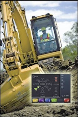
GPS Compares Bucket to Plan In Custom Color Graphics
Leica's DigSmart 3D Excavator Guidancesoftware colorfully displays project designs and position of the bucket in three dimensions as identified by a dual-antenna GPS receiver. The Slope Tool minimizes over-excavation by continuously monitoring the edges of the bucket, determining which edge is lowest, and comparing it to the 3-D design model. Other systems use the center of the bucket as a reference. Similarly, the Trench Tool automatically selects the edge of the bucket nearest either side of the trench to use as a reference. Estimated list price: $59,995.


