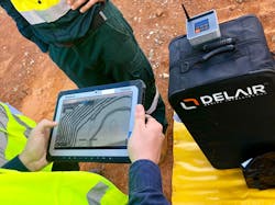
Delair Aerial Intelligence Platform
The Delair Aerial Intelligence platform for converting drone-based images into actionable business insights is a cloud-based solution designed to provide a complete integrated and easy-to-use workflow to manage, analyze, and share data, streamlining the process for unlocking the true potential of aerial surveying.
Industry-optimized analytics are available for specific industries and use cases in mining, quarries, construction, power and utilities, and agriculture. The platform is hardware-agnostic, and intuitive commands allow the user to visualize a site in 2D or 3D, and include support for orthophotography, slope maps, digital surface models and 3D models. Measurement is made quick and simple with integrated toolsets for calculating length, determining an area size, or calculating stockpile volumes.
Real-time collaboration is enabled through annotation features, integrated conversation threads, and instant notifications from team members. It allows drone data to be overlaid with other geospatial data, supporting popular commercial formats and allowing data to be easily exported to a range of industry-standard software suites and reporting formats.
