When Russ Chrisman launched his excavating business three years ago, he had a strong hunch that grade-control technology relying on global positioning system (GPS) satellites would become his small company's competitive advantage. Revenues have doubled in each of the last three seasons, and he's pretty certain he was right.
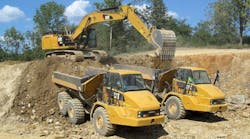
Chrisman began the first year with four primary Caterpillar earthmovers: two dozers — a D6R and a D4 — and two excavators — a 322 and a 325. He hired three operators and the four of them worked that first season the traditional way, with grade stakes and simple laser grade guidance.
"I had a special code on our time cards for tracking the amount of time that each of us spend off the tractors setting grade stakes," Chrisman says. "Three of us had 892 hours out of the machines just doing staking work that first year.
"There was no way we could keep up," he adds. "I was looking at either hiring someone to do the staking [he estimates it would have been a $70,000- to $80,000-per-year proposition] or buying the GPS grade control system and eliminating a lot of grade stakes."
Chrisman put together a simple cost justification based on his time study and made the case to his banker. With an initial investment of about $150,000, he equipped the two dozers with Trimble Auto Sitevision systems, bought two GPS base stations, and set up earthmoving systems capable of automatic grade control.
RC Excavating's investment in staking time dropped to about 100 hours in the second year even as revenue doubled.
"I've never had one of my guys calling in to say he's shut down because he doesn't know what to do next," says Chrisman. "They have the whole job model right there on their screens, so they can go anywhere on the site and they know what needs to be done."
Chrisman ascribes much of the success to his employees. In fact, he is an excavator operator, so he scarcely used the grade controllers in the field himself. His operators are construction veterans innovative enough to want experience with the advanced technology. They knew why Chrisman was keeping track of staking time, and that his plan was to go stakeless with GPS controls.
"For GPS grade controls to really work, you've got to have operators who are charged up about the technology and take some pride in using it," says Chrisman. "You can wind up with a real mess on your hands if the accuracies get too far out and the operator thinks, 'It's good enough," and keeps right on working [the cab display shows when GPS accuracy has degraded because the receiver isn't getting signals from enough satellites]."
Chrisman still has engineers stake some stations on most jobs so that his operators can double check alignments and grades. RC operators make note of the elevations that inspectors write on manholes and hydrants and other site infrastructure, and they check elevations at all the marked stations.
"We get out and take a few shots with a laser to the hubs at the start of most jobs, too," says Chrisman. "The contractor is responsible to check the benchmarks. If you don't, you can set yourself up for problems."
As an example, he recalls when one local municipality's engineering department reestablished benchmarks throughout its jurisdiction. But the numbers on some plans that RC Excavating was to complete hadn't changed to reflect the altered benchmarks.
"If we had designed our model using the old data, we would have been off by about three inches all over the site," says Chrisman. "But we got to the bottom of it and were able to correct the whole thing just by adjusting our offsets at the controller in the cab."
Other challenges were more technical.
"Working with Terramodel to put the project plans into a digital model was the scariest thing about it," Chrisman says. "The system depends on a lot of information coming in that has to be put into a digital design before the machines can go to work.
"Before I could pull the trigger on buying the systems, I had to make sure I was able to design a road and load the model on the dozer's grade control."
None of the projects RC Excavating has done began with a complete, three-dimensional electronic model that could be plugged in simply to the Trimble computers. Chrisman, who is neither an engineer nor a computer geek, had to learn how to translate two-dimensional plans into the electronic models that automatic grade-control systems follow when they guide the blade.
"Our Trimble rep sent me a 45-day trial version of the Terramodel software and a 52-page PowerPoint that described how to get started," says Chrisman. He sat down at the computer in the evenings and worked through the PowerPoint slides and Terramodel's online help. "In a week I was feeling pretty good about the system. In two weeks I was ready to place an order."
He says for RC Excavating's site-prep purposes, the task is relatively simple. Project designs supply a series of three-dimensional points — locating them with longitude, latitude, and elevation — that describe the project's centerline. And the rest of the project is made up of vertical offsets from that centerline. He identifies manholes and other fixtures that could be damaged but leaves out project details that the site-prep contractor will never have to touch. As long as the subgrade is where it needs to be, the dozer operator doesn't need to see curbs and other infrastructure that will be placed on top after RC Excavating's work is finished.
"You can build a lot of a design model pretty easily by creating a template and then just copying and pasting it where you need it," says Chrisman. "It really was easier than I thought it would be."


