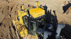
The DigSmart 3D Excavator Guidance System uses a color monitor to graphically display project-design information and 3D GPS position. The system has a high level of integration with survey data via technology such as the DBX format for data, Roadrunner software, System 1200 data for coordinate transformations and GPS 1200 sensor modules.
 The DigSmart 3D Excavator Guidance System uses a color monitor to graphically display project-design information and 3D GPS position. The system has a high level of integration with survey data via technology such as the DBX format for data, Roadrunner software, System 1200 data for coordinate transformations and GPS 1200 sensor modules.


