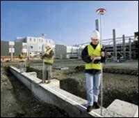
Leica GPS900 RTK GPS system
The new GPS900 RTK GPS system from Leica-Geosystems is a complete base and rover system conveniently packaged in a single, "ruggedized" case. The system, says Leica, provides a complete, low-cost, turnkey GPS surveying solution that can be easily transported to the worksite. The new system’s rover is a lightweight, all-on-the-pole, cable-less, dual-frequency RTK GPS surveying instrument designed specifically with one-person operation in mind. According to Leica, the GPS900 system incorporates the company’s SmartCheck GPS RTK technology, provides centimeter-level accuracy, fast acquisition times, 2 Hz position update rate and has a range of 1.5 miles from the base station.
 The new GPS900 RTK GPS system from Leica-Geosystems is a complete base and rover system conveniently packaged in a single, "ruggedized" case. The system, says Leica, provides a complete, low-cost, turnkey GPS surveying solution that can be easily transported to the worksite. The new system’s rover is a lightweight, all-on-the-pole, cable-less, dual-frequency RTK GPS surveying instrument designed specifically with one-person operation in mind.
