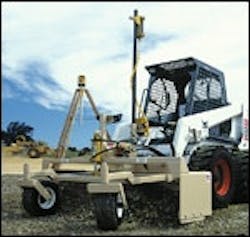
The Level Best laser grading box automatically finishes grades up to 1/8-inch accuracy. The digital-proportioning hydraulic system makes adjustments automatically, with one operator being able to finish-grade up to 50,000 square feet in an 8-hour day. Tractor-mount and skid-mount boxes are available, ranging from 60- to 108-inch widths. The skid-steer model includes a universal mounting plate for fast attachment to different skid-steers. The grading boxes are available for Laser Alignment or Topcon controls.
Topcon
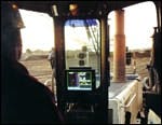
Combining GPS tracking with digital plan data, the 3D-GPS system allows the operator to grade any design surface within a few centimeters' accuracy. The software has a single or multiple design axis capability, and includes a digital terrain model (DTM) function for virtual plan review. The on-board display shows the equipment location on the job plan in real-time and provides the operator with the related design elevation, design slope, actual blade slope and distance to finish grade data while operating in either manual and automatic mode.
Apache
Trimble
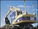
A new version of the SiteVision GPS machine guidance and control system allows equipment operators to accurately perform earthmoving operations by placing the site design in the cab and using GPS technology. The system can be used with dozers, scrapers, motor graders and now, excavators. High-speed linear encoders provide data used to compute the position of the excavator's boom, stick and bucket. The operator can view the long section of the design, especially useful if the bucket is underwater or otherwise not visible from the cab. Also, the operator can view the current position of the machine relative to the digital design of the job.
Trimble
The BladePro 3D machine control system combines TerraModel software with position information and the BladePro dual control system to deliver an automated fine-grading solution. The system uses a GPS receiver or ATS to measure the X–Y and Z coordinates, and compares the current position to the preloaded digital terrain model of the project. Design elevation and cross-slope for the current position are then calculated for the current position, and the system automatically moves the blade to the correct cut or fill position elevation and slope.
Leica Geosystems
Dozer 2000 is a GPS-based machine guidance system that consists of a Leica ruggedized high-precision GPS receiver, radio data receiver and touchscreen computer running on specialized Dozer 2000 software. The GPS antenna is mounted on top of the cab, with the GPS receiver calculating its position in three dimensions 10 times per second. The GPS position data is corrected for local-area errors using differential data transmitted from a fixed DGPS reference station, producing position accuracies of 1 to 2 inches in real time.


