Blue Goose Construction of Fort Pierce, Fla., conquered what might be the prototype application for GPS grade control on an excavator, relining a mile-long canal on the Florida coast. The banks were eroded by recent hurricanes, and as the source of cooling water for a nuclear power plant, the 25-foot-deep canal had to remain full of seawater throughout the project.
Working with general contractor Underwater Engineering Services of Port St. Lucie, Blue Goose developed an underwater application of a Topcon grade-control system indexed by Global Positioning System (GPS) satellites.
“A decision was made to rebuild the canal and line the walls with protective mats made of concrete blocks linked with cables,” said Blue Goose General Manager Larry Tarr. “Specifications were very tight. We were allowed only a 6-inch tolerance in the finished surface, which meant the real tolerance we had to work to was much smaller.”
Each embankment is 135 feet long with a 3:1 slope, two-thirds of which is under water. The bottom is 40 feet wide.
“We had to repair the erosion damage, then place, level, and compact a base of crushed stone and coarse sand before installing the mats,” Tarr said. “We couldn't just dump the fill because the sand and stone would separate; it had to be placed and compacted one bucket load at a time.”
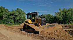
Blue Goose commissioned Nortrax of Florida to build four special long-reach excavators starting with a John Deere 850D, a 450D, and two 240D excavators. Jewell Manufacturing built the booms. The JD 850D has a reach of 95 feet, the 450D can reach 70 feet, and the 240Ds each reach 60 feet. Heavy-lift kits and special counterweights allow them to lift rated load at full extension, but doing the work with precision remained a challenge.
“The machine operator can't see what's happening at the end of a 90-foot boom that's under 25 feet of water, but we still have to meet the specs,” says John Allen, senior project manager. “The answer, of course, is to equip the machine with a high-precision GPS location system for excavators that tracks the bucket location and displays it for the operator along with the actual grade and specified grade. Sounds simple, but we quickly discovered that the system we needed didn't exist.”
The vendor of laser and GPS systems Blue Goose had worked with before couldn't offer a solution.
“So we started talking to other GPS suppliers including Lengemann Corp., a Topcon distributor here in Florida,” Tarr said. “Jay Waller, the local representative, said nothing in the standard product line fit our requirement, but Lengemann and Topcon would be glad to work with us.”
Each excavator is equipped with a Topcon Dual GGD Spread Spectrum receiver that precisely locates it to within a few millimeters in three dimensions. Waterproof position sensors attached to the boom, stick and bucket track and report their motions. The software and display technology puts all the data together.
“Everything is combined in the onboard computer to create a readout that shows the exact location of the bucket to within a few tenths of a foot in real time,” says Allen. “The unit has proven to be very rugged and reliable on the job and delivers all the accuracy promised.”
A survey database stored in the computer shows the actual contours of the embankment and a model of the finished grade. They show up on the display as a pair of contour lines along with a side view of the bucket.
“All the operator has to do is watch the display and put the bucket where it's supposed to be,” says Allen. “Sounds easy, but teaching the operators how to use the system was one of the biggest challenges we faced on the project.”
The work was completed on schedule, without a hitch.